By Rachael Stein, Northeast-Midwest Institute Intern and Graduate Student at the University of Colorado at Boulder
The Great Lakes hold about 20 percent of the world’s freshwater and supply drinking water to over 40 million people in the U.S. and Canada. They generate 1,500,000 jobs and $62 billion in wages annually. But despite being a vitally important resource, most of the lakebeds have not been mapped in detail. Only around 15 to 18 percent have high-resolution hydrographic surveys, which makes it harder to understand underwater habitats, track sediment and water movement, and analyze how changes in the lakes could affect people and communities.
Lakebed 2030 is a multi-national project set up to fill that gap by bringing together U.S. and Canadian government agencies, universities, indigenous nations, and local organizations. The project builds on lessons from the global Seabed 2030 effort, adapting its tools and standards for freshwater lakes. There are a lot of challenges when it comes to mapping the Great Lakes. Agencies need to coordinate across many jurisdictions, cover huge stretches of water, and work with data that in some areas is decades old and may contain sensitive cultural information. Lakebed 2030 aims to produce detailed, reliable maps that researchers, managers, and communities can actually use. Over time, it would also create a system for ongoing monitoring and collaboration across the lakes.
A bipartisan bill in Congress, the Great Lakes Mapping Act of 2025, would establish a federal program to complete high resolution mapping of the Great Lakes lakebeds by 2030. The bill directs the NOAA Administrator to lead the mapping effort and coordinate with state agencies, tribal nations, and regional partners. It authorizes 50 million dollars per year over five years to support surveys, data processing, and open public access to the resulting maps and data. Should the bill become law, it would create the first dedicated federal initiative focused on modern lakebed mapping across the entire Great Lakes.
Players and roles
Lakebed 2030 started with early efforts led by the Great Lakes Observing System (GLOS) and Northwestern Michigan College, which continue to host the annual Lakebed 2030 conference to connect stakeholders and display new innovations. Since the initial event in 2019, more groups have joined, each contributing expertise, local knowledge, and guidance on policy. “Lakebed 2030 took off because people finally had a place to come together and talk openly about gaps and possibilities,” GLOS CEO Jennifer Boehme said.
GLOS plays an important role in Lakebed 2030 because they already manage tools people use to understand what is happening on the Great Lakes. GLOS’ mandate is to collect Great Lakes data from disparate sources and make it publicly accessible and digestible for everyone from those in government and academia to everyday people going out on the water. GLOS’ Seagull platform, for example, displays lake conditions, weather, currents, and water quality in one place for easy access. “Our goal is to be the Google of the Great Lakes,” Boehme said. GLOS has already built the infrastructure and networks that can be leveraged in support of the broader mapping project, allowing new mapping data to be used by communities, scientists, and government agencies without barriers. The Great Lakes Mapping Act explicitly includes GLOS as one of the regional partners that would support NOAA’s work in this way, helping coordinate surveys, organize data, and disseminate information to the public.
The National Oceanic and Atmospheric Administration has played a large part in Lakebed 2030 by providing survey vessels, technical expertise, and federal mapping standards through the Integrated Ocean and Coastal Mapping (IOCM) program. Because NOAA, which has long been directed by Congress to conduct bathymetric mapping, already contributed data and survey work to the global Seabed 2030 effort, many of its mapping standards and data workflows were already in place. This included processes for collecting and storing bathymetric data in the National Centers for Environmental Information (NCEI), and working with other agencies involved in mapping. As a result, when discussions began on a freshwater Great Lakes effort, NOAA could apply much of its existing approach to Lakebed 2030, and the goals of the project fit within NOAA’s responsibilities for hydrography, navigation safety, coastal mapping, and communicating data to the public.
Coordination across agencies and borders is a major part of NOAA’s work in the Great Lakes. Heather Stirratt, who recently retired from 24 years of federal service with the International Joint Commission and NOAA combined and now chairs the GLOS board of directors, talked about how challenging that coordination can be and why a shared effort like Lakebed 2030 matters. “Without a program like Lakebed 2030, we would be left with fragmented data that limits how we respond to environmental and navigation needs,” she said.
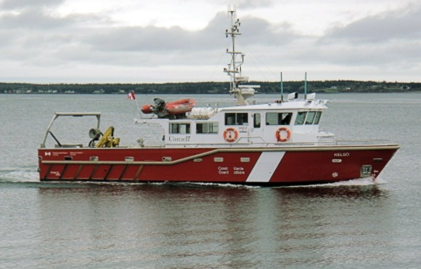
The Canadian Coast Guard Vessel Kelso, used to survey near-shore and off-shore in the Great Lakes. Photo: Canadian Hydrographic Service
The Canadian Hydrographic Service (CHS) is a division within Fisheries and Oceans Canada, the national authority on hydrography and bathymetry. Within Lakebed 2030, CHS collects detailed lakebed data using a wide range of tools including traditional survey vessels, along with modern tools such as aircraft borne LiDAR, and uncrewed survey vessels. CHS manages Canada’s bathymetric data holdings and makes the data publicly accessible. They also work with U.S. partners, including NOAA, to share data and make sure the maps are useful for navigation, environmental monitoring, and planning projects along the Great Lakes.
The U.S. Environmental Protection Agency (EPA) and Environment and Climate Change Canada (ECCC) help guide the policy and priorities of Lakebed 2030, ensuring that U.S. and Canadian requirements are coordinated through the Great Lakes Water Quality Agreement (GLWQA). The IJC tenders advice to the US and Canadian governments regarding research and monitoring of the Waters of the Great Lakes including recommendations for specific scientific priorities like lakebed mapping. The U.S. Geological Survey (USGS) provides scientific expertise and collects environmental data that supports mapping, habitat studies, and understanding sediment and water processes. Indigenous and regional partners contribute local knowledge, help identify areas of cultural or ecological importance, and ensure that Indigenous data governance principles are respected. Together, these partners help ensure Lakebed 2030 is both scientifically rigorous and relevant to local communities.
Why Mapping Matters
The Great Lakes are among the world’s most significant freshwater resources, but much of the lakebed remains poorly mapped. A lot of the bathymetry data that does exist is outdated, from the mid-20th century or older, and no longer accurate. The lack of seamless maps complicates the ability of natural resource managers to illustrate ecological features, such as spawning grounds, that may cross international borders. These inaccuracies make it difficult to generate quality data related to water flow modeling, habitat conditions, and much more.
Updating these maps is essential, but it doesn’t come cheap. A large barrier to completing the project quickly are the high expenses associated with research vessels, equipment, and personnel. There is an estimated cost of between $50,000 and $80,000 for one single day of high-density bathymetric mapping. This doesn’t begin to estimate the cost of multi-platform approaches, which must be considered to ensure that turbid or sediment-filled water columns or severe weather don’t foul attempts to collect high quality mapping data. Due to the vastness of the Great Lakes, the costs of this initiative will be significant.
Modern lakebed mapping justifies the price tag by providing significant economic, ecological, and public health benefits. The mapping project has the potential to transform approaches to ecosystem management, provide a better understanding of how the lakes are changing through erosion and climate change, and even uncover long-lost shipwrecks.
A key area that would benefit from updated mapping is ecosystem and habitat management. The Great Lakes support a wide variety of species, but many of their underwater habitats are still poorly understood because past mapping methods missed smaller and more complex features. High resolution data would open the door to new research on fish habitats and spawning grounds, including the impact of shifting lakebed conditions on native fish. This information is vital to fisheries management and aids in long term ecological planning which is necessary to keep fish populations thriving.
⼮
What Do You Want People to Know About the Great Lakes?
Jen Boehme, CEO of GLOS:
"I want people to understand how interconnected the lakes are with the communities around them. The data we collect is only useful if people can see the lakes as part of their everyday lives, not just on a map."
Heather Stirratt, Former NOAA Great Lakes Regional Lead and IJC Great Lakes Regional Director
"It’s important for people to see that modern mapping isn’t just about charts. It supports environmental decisions, safety, and understanding how the lakes respond to storms and climate change."
Chris Marshall, Canadian Hydrographic Service
"I hope people realize that there’s still so much we don’t know about the lakebeds. Having detailed maps changes how we can protect ecosystems, forecast events, and make decisions that affect both people and wildlife."
⼮
Invasive species are a massive problem in the Great Lakes, as quagga and zebra mussels, sea lampreys, round gobies, and alewives have drastically altered ecosystems. Detailed bathymetric maps not only help identify habitats that are most vulnerable to invasive species, such as shallow or sheltered areas on the shoreline, but can also identify underwater pathways that invasive species spread through. These maps would also improve monitoring and early-detection efforts by informing agencies on where to place sensors and sampling equipment. Knowing the contours and substrate of the lakebed also helps managers find areas where invasives can cluster and tailor removal and treatment methods accordingly.
Another benefit to detailed data is erosion mitigation and flood protection. Rising water levels and stronger storms from climate change have increased erosion. Accurate lakebed modeling can improve weather forecasting and shoreline protection. Sediment tracking is also vital to cleaning up contaminants in legacy pollution sites, including Areas of Concern (AOCs). Sediments move across the lakebed in complex patterns, and can carry pollutants like PCBs, PFAS, and heavy metals. Storms can stir these pollutants back into the water, affecting the pattern. Without detailed data, models can only estimate these movements, which makes cleanup less effective. Lakebed 2030, however, would supply managers with the accurate information they need to guide restoration and remediation planning.
The floor of the Great Lakes holds a wide range of cultural and historical treasures that are out there to find. Thousands of shipwrecks are believed to rest on the lakebed, many connected to early shipping routes, immigration, and commercial history. As Boehme noted, “The Great Lakes have thousands of hidden shipwrecks, and that speaks to the region’s maritime history.” Only a fraction of these wrecks have been located, but high-density mapping could uncover them.
There are also submerged landscapes that were once exposed before water levels rose after the last ice age. In Lake Michigan, divers reported a circular alignment of stones in Grand Traverse Bay that resembles prehistoric structures found on land. One stone appears to contain an image that some interpret as a mastodon, although this has not been confirmed. Discoveries like this show how much cultural history may still be hidden beneath the surface.
Higher resolution mapping can help identify and protect shipwrecks, archaeological features, sinkholes, and other culturally important places. It also supports indigenous nations, researchers, and local communities who have emphasized the need to better understand the historical and cultural resources within the lakes.
Navigation, recreation, and public safety would stand to benefit as well. Improved accuracy in measurements would improve navigational safety. Updated mapping can also improve recreational boating safety and help predict rip currents more accurately. More sustainable infrastructure can be designed proactively by planning for coastal erosion.
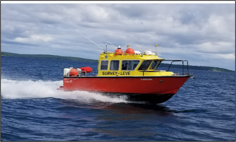
A Canadian Hydrographic Service research vessel used to survey near-shore in the Great Lakes and in channels. Source: Canadian Hydrographic Service
How the Lakes Are Surveyed
In the last several years, mapping technology has improved greatly, and that has made it much more realistic to think about completing large sections of the Great Lakes that have not been surveyed. A big part of this change comes from new autonomous tools, like uncrewed surface vehicles (USVs) and autonomous underwater vehicles (AUVs). These systems don’t need big crews, so they’re cheaper to run, and they can stay out longer than a regular survey boat. CHS has tested them in Lake Superior and a few other places, and they’ve been able to cover surprisingly large areas while also collecting things like temperature and turbidity data at the same time.
Crowdsourced bathymetry is also playing a role, especially through platforms like Seagull. Recreational boaters can upload depth data from their own equipment, which can help fill in some of the smaller gaps. This works especially well in clearer areas of the lakes, (which happens to often be places where invasive mussels have increased water visibility) because satellites can also contribute. These tools don’t replace surveys, but they can make the job easier and more efficient than it used to be.
Mapping the Great Lakes is a massive undertaking, and it requires a lot of people and organizations working together. Lakebed 2030 hinges on collaboration between U.S. and Canadian agencies, local groups, tribes, and research organizations. Steering committees and working groups help coordinate who does what, which areas need surveying and on what timelines, and how to share the data once it’s collected.
Multi-national coordination is another complexity. U.S. and Canadian agencies can sometimes have different priorities, funding structures, and legal frameworks. Programs like the GLWQA provide a policy framework that helps both countries. The collaboration so far has been strong, and both countries continue to find ways to make the data work with other models and mapping projects. Indigenous and tribal partners are also a critical part of the process. Lakebed 2030 follows OCAP principles, which means any data involving Indigenous communities is owned, controlled, accessed, and possessed by those communities. This ensures traditional knowledge and local priorities are respected, while still letting the data be used for bigger regional mapping and research.
Lakebed 2030 gives agencies and communities new ways to use data they didn’t have before. Programs like the Great Lakes Restoration Initiative and the Canadian Oceans Protection Plan provide funding to keep sensors and staff in the field, while data-sharing policies and binational governance make it easier for everyone to use the same surveys without duplicating work.
Lakebed 2030 will also assist with education and training. Courses and workshops connected to the project are teaching students real-world skills in bathymetry and surveying. Over time, this will help grow and sustain a flourishing community of professionals working to expand the work into more lakes and areas. Additionally, Lakebed 2030 will contribute to investments in technological innovations that will make mapping more efficient for its duration and beyond.
Lakebed 2030 shows how much there is still to learn about the Great Lakes. Even with decades of research, most of the lakebeds remain unmapped in detail, and that missing information affects everything from ecosystem management to navigation and recreation. It’s not just about making maps; it’s about having real information to make better choices for the lakes and the people around them.
Critical to the success of Lakebed 2030 is integration and coordination between a wide network of partners. Federal and state agencies, Canadian partners, universities, indigenous nations, and local communities are all involved. Collaboration helps improve data quality and ensures it can be applied to real-world management decisions around the lakes.
Looking to the future, Lakebed 2030 will evolve from a short-term effort to a program that regularly updates lakebed maps. New tools and mapping techniques make it easier to gather detailed data. Working together across the U.S. and Canada means the maps can be used for things like tracking environmental changes or planning restoration. By combining high-resolution mapping with local knowledge and regular updates, the project supports better decisions across the Great Lakes.
Lakebed 2030 is built on the idea that we cannot manage what we do not monitor. The work already underway shows how much can be learned when partners share data, coordinate surveys, and focus on the entire system instead of just its constituent parts. The Great Lakes Mapping Act would give this effort the structure and support it needs to continue at a meaningful scale and reach a complete, reliable, and seamless map of the lakebed. The map is a vital planning tool, but for the people across the Great Lakes who depend on these waters, it also supports safety, restoration, and long term stewardship of a landscape that has shaped communities for generations.
⼮
Why Do We Need Lakebed 2030?
Jen Boehme, CEO of GLOS:
"Our goal is to make Great Lakes data accessible and useful for everyone, from researchers to local communities. Mapping is only valuable if people can actually use the information."
Heather Stirratt, Former NOAA Great Lakes Regional Lead and IJC Great Lakes Regional Director
"Coordination across agencies and borders is challenging, but it’s essential. Without a program like Lakebed 2030, we’d have fragmented data that limits how we respond to environmental and navigation needs."
Chris Marshall, Canadian Hydrographic Service
"High-resolution lakebed mapping gives us the detail we need to understand sediment movement, predict storm impacts, and support both ecological and public safety decisions."
⼮